To achieve California and the post-Paris world’s climate goals, we’re going to need a whole lot more renewable energy. Given current market trends, much of it will come from solar photovoltaic (PV), which has gotten incredibly cheap in the last few years. But deploying these solar panels at utility scale will mean major changes to our landscapes. And that means conflicts with traditional environmental and agricultural values.
Here in California, these conflicts could slow the state’s effort to achieve 50 percent of our electricity from renewable sources by 2030. A significant deployment of large-scale solar PV will occur in places like the San Joaquin Valley, an agriculturally rich region with lots of solar exposure (insolation) but tremendous poverty and air pollution. To date, many proposed solar PV projects in the region have engendered conflict with agricultural and conservation groups, who fear a resulting loss of valuable lands and the species and farming and ranching that depend on them (a subject of a 2011 joint UC Berkeley/UCLA Law report, funded by Bank of America, called Harvesting Clean Energy).
 To address the challenge, Berkeley Law’s Center for Law, Energy and the Environment (CLEE) partnered with Conservation Biology Institute (CBI) and Terrell Watt Associates to develop a new, stakeholder-based process to find “least-conflict” lands in the eight-county San Joaquin Valley region. The project team convened leaders from the agricultural, conservation, and solar PV development communities, and included tribes and key agencies.
We asked the groups one question: from your perspective, where are the least-conflict lands for solar PV development in the Valley?
And here is where technology came into play. To answer this question, the group worked with CBI’s cutting-edge but straightforward on-line mapping platform, called Data Basin Gateway. This new mapping software allowed for real-time, group-supported mapping as the stakeholders were free to input their own data and share the results, privately at first among their group, and then with the larger stakeholder groups.
Once we overlaid the various stakeholder groups’ final maps, the result was pretty remarkable:
- Out of the 9.5 million acres in the stakeholder study area, the groups identified 470,000 acres of ideal, non-controversial land for solar PV development.
- The amount of land is roughly equal to 5 percent of the entire Valley study area.
- At a generic calculation of 1 megawatt of solar PV production from 5 acres of panels, the lands identified could provide 94,000 megawatts of renewable power – greater than all combined current in-state generation capacity and enough to power as many as 23 million homes in California — just from the San Joaquin Valley.
To be sure, not all of this land, on further inspection, may be practical or feasible for solar PV development. But if even a fraction works, it will accelerate the state’s renewable efforts and reduce the impact of air pollution on Valley communities. Perhaps even more encouraging, this entire process took less than six months, and the resulting maps remain on-line on the San Joaquin Valley Gateway, where stakeholders can update the maps as new data become available and conditions change over time.
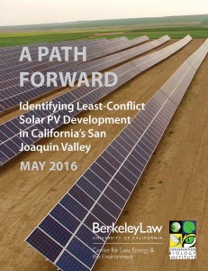
You can learn more about the results in the new CLEE/Conservation Biology Institute report released today called “A Path Forward: Identifying Least-Conflict Solar PV Development in California’s San Joaquin Valley,” available on the report page here.
Based on the results, CLEE urges policy makers to encourage solar expansion on these optimal lands and streamline the planning processes to steer more solar PV development there. Such efforts could include:
- Siting and fast-tracking appropriate transmission capacity to these lands;
- Developing permitting incentives for projects proposed in these areas, such as reforms to the Williamson Act and advance mitigation procedures under the California Environmental Quality Act; and
- Further study on the potential compatibility of solar PV with agricultural practices.
CLEE also encourages policy makers to support similar mapping processes throughout the state and eventually for a multi-state effort across the United States. There’s no reason this same process can’t work for a statewide mapping effort and more, or even for technologies beyond solar PV. After all, we’ll need other clean technologies in addition to renewables to meet our climate goals, from energy storage to low-carbon transportation.
To learn more, tune in to a webex briefing from the Governor’s Office today at 4pm (no password required). You can also dial in at 1-650-429-3300, access code 926 702 170. The webex will feature remarks on the report findings from Ken Alex, senior advisor to Governor Brown and director of the Governor’s Office of Planning and Research (and CLEE advisory board member and guest Legal Planeteer), and California Energy Commissioner Karen Douglas (both of whom were instrumental in getting the project launched and implemented).
Finally, I encourage readers to review the full report and note the list of stakeholders and others involved to bring this project to fruition, including generous contributions from the Energy Foundation, The Nature Conservancy, and others.
Let’s hope this work not only helps resolve conflicts in the San Joaquin Valley to bring more renewable energy on-line but also inspires similar smart planning efforts for clean technology throughout California and beyond.
2 thoughts on “Finding Least-Conflict Lands For Solar PV In California’s San Joaquin Valley — And Beyond”
-
Pingback: Mapping Infill Opportunity Areas In California | Ethan Elkind
-
Pingback: Capitol Weekly Op-Ed On Mapping Solar PV Land In The San Joaquin Valley | Ethan Elkind
Leave a Reply
You must be logged in to post a comment.